Setting Course for a More Sustainable Future
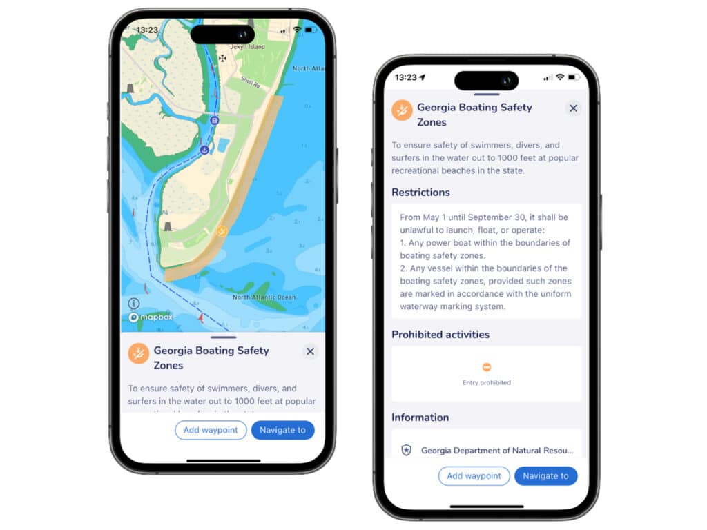 savvy navvy helps boaters know and comply with conservation rules on the water.
Courtesy savvy navvy
savvy navvy helps boaters know and comply with conservation rules on the water.
Courtesy savvy navvy
Boaters worldwide can now access to the most comprehensive resource of ocean regulatory information, including marine protection areas, through the savvy navvy app. Made possible through a collaboration between savvy navvy and ProtectedSeas, a data-driven and ocean-focused business headquartered in Silicon Valley, California, the app aims to empower boaters with information to make more environmentally conscious decisions while out on the water.
ProtectedSeas Navigator currently provides boaters with 22,000 marine protected and managed areas in more than 220 countries across the world. This includes speed-limit zones to protect marine mammals, fisheries management areas among other protections.
“Working with ProtectedSeas enables us at savvy navvy to bring their valuable research to life and help anyone on the water to make better decisions to protect the environment,” said David Cusworth, head of innovation and partnerships at savvy navvy. “We like to do things differently, and building on our seagrass data from last year, we will now have a whole layer of information just about sustainability. This partnership is the latest in savvy navvy’s ambition to bring sustainability to the forefront of boaters across the globe, as we continue to make navigation safe and easy for everyone on the water.”
ProtectedSeas scoured the globe to compile marine protection information into the Navigator database of marine protected areas (MPAs), both large and small, including creating the first public digital maps for over 2,400 areas—roughly 10 percent of the areas included in the database. Launching their digital data after eight years of research and development, savvy navvy now delivers the Navigator data to boaters and watersports users all over the world via their app.
“ProtectedSeas is excited to see Navigator information in the hands of boaters on the water,” said Virgil Zetterlind, director of ProtectedSeas. “Through our partnership with savvy navvy, boaters are more empowered to know and comply with conservation rules on the water which help protect the ecosystems they know and enjoy.”
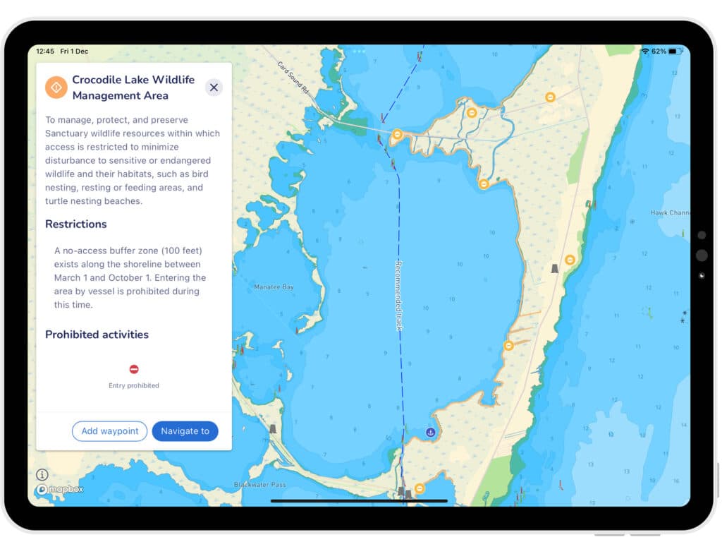 Through its app, savvy navvy hopes to bring sustainability to the forefront of boaters across the globe.
Courtesy savvy navvy
Through its app, savvy navvy hopes to bring sustainability to the forefront of boaters across the globe.
Courtesy savvy navvy
Since launching their first global view of marine life protections, ProtectedSeas has been complimented by several industry-renowned leaders and bodies, including the U.S. National Oceanic and Atmospheric Administration (NOAA), Dr. Sylvia Earle, and the governor of California. Savvy navvy, often referred to as “Google Maps for boats,” is a revolutionary, award winning boat navigation app that aims to deliver information needed by boaters for a seamless experience on the water, all in one place. They were among the first to integrate multiple sustainable data sources from different conservation agencies and bodies. Some of the ProtectedSeas data is already live in the savvy navvy app now, with more to follow soon.
To learn more about the sustainable data or to download the app visit savvy-navvy.com
The post Setting Course for a More Sustainable Future appeared first on Cruising World.