How Marine Electronics Could Save North Atlantic Right Whales
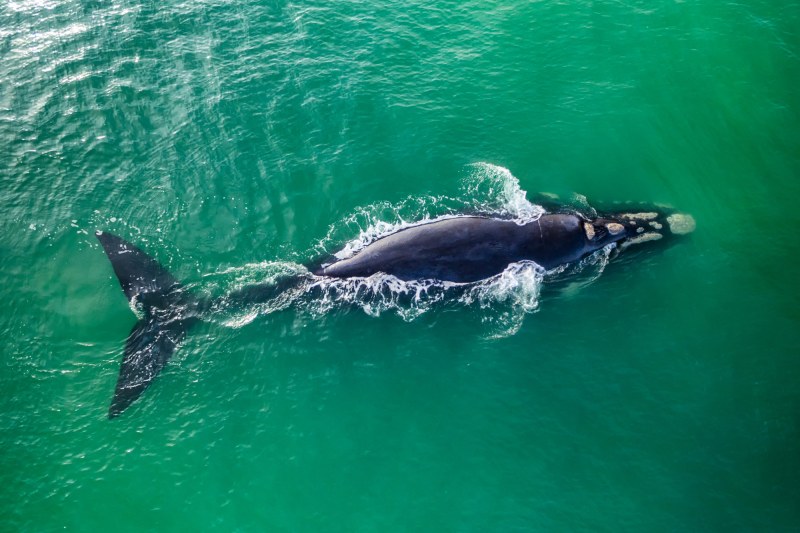 Technology, rather than blanket vessel speed restrictions, are the industry’s preferred solution.
softfocusphoto/stock.adobe.com
Technology, rather than blanket vessel speed restrictions, are the industry’s preferred solution.
softfocusphoto/stock.adobe.com
In 2008, my dad, two friends and I were delivering my dad’s former J/44 from Connecticut to Maine via the Cape Cod Canal. A becalmed morning found us motoring past Race Point Lighthouse, where a humpback whale surfaced just off our port bow. We idled for several magical minutes, our eight eyes staring at its two, before our new friend resubmerged.
The encounter left me wondering what might have happened if we’d been sailing fast on a different course. And not just with regard to humpbacks.
North Atlantic right whales are the most endangered whale species on the Eastern Seaboard. The National Oceanic and Atmospheric Administration estimates that about 380 remain, of which about 70 are breeding females. These are scrawny numbers compared to pre-whaling populations, which is one reason why the Whale and Vessel Safety Taskforce is working to protect this species and other marine mammals from vessel strikes using marine electronics and data-driven alerts.
Viking Marine Group created the WAVS Taskforce in late 2022 following government attempts to regulate recreational boating in ways that the National Marine Manufacturers Association described as an existential threat to the industry. North Atlantic right whales have been listed under the Endangered Species Act since 1970, and the North Atlantic Right Whale Vessel Strike Reduction Rule, from 2008, put 10-knot speed limits in place along swaths of the East Coast for vessels 65 feet and larger for up to seven months each year.
What changed in 2022 was that NOAA Fisheries proposed amending this rule to expand speed zones, create mandatory speed restrictions and include most vessels 35 feet or larger. The WAVS Taskforce was formed as a volunteer-based, 501(c)(3) nonprofit organization to see if the industry could come up with a scalpel-based approach, rather than blanket regulation, to protect whales while still allowing boaters to recreate at pace.
NOAA Fisheries has since eased off the regulatory threat, but the WAVS Taskforce remains committed to its mission.
 WAVS is focusing on using already-onboard sensors, rather than innovating new ones.
Courtesy Yamaha Motor Corp, USA
WAVS is focusing on using already-onboard sensors, rather than innovating new ones.
Courtesy Yamaha Motor Corp, USA
“We want to bring together the marine industry, the experts in the field and the manufacturers, and have a venue where we can discuss how we move forward, and address this issue from a technology perspective,” says John DePersenaire, Viking Marine Group’s director of government affairs and sustainability and the WAVS Taskforce’s chairman. “The main goal is to leverage innovation and technology to help mitigate the risk of vessel strikes.”
Part of this plan involves bidirectional data flow. There isn’t a central globalized repository for whale data, let alone one that supports analytics and data processing. However, NOAA and conserve.io each maintain databases. The latter is available on the WhaleAlert app.
DePersenaire says right-whale sightings from official observers working for federal or state agencies are included in these repositories in near real-time, while sightings from average boaters can take a day or two to be verified before the data is included.
WAVS is working to shrink this chronological gap using metadata that allows repository gatekeepers to vet observation information, along with automated technologies.
“We’re seeing great advances in the AI classification space,” DePersenaire says, referring to optical-based collision-avoidance systems. This technology, he adds, could be used to identify and classify whales automatically.
Matthew Zimmerman, FarSounder’s CEO and a WAVS Taskforce member, puts it like this: “We need to have automated systems to help manage the amount of data that will be needed. I don’t think that unleashing the AI will just take care of all of it, but I think it could be a really useful tool.”
Zimmerman says WAVS is focusing on using already-onboard sensors, rather than innovating new ones. “It’s harnessing what’s already out there and making them connect together,” he says.
This strategy requires interoperability and integration across different proprietary technologies, which, Zimmerman says, is also critical to the WAVS mission.
An example of this pertains to NMEA 0183 sentences and NMEA 2000 parameter group numbers, which all NMEA-certified multifunction displays can read. WAVS is working with the NMEA to create two whale-related sentences (and N2K PGNs). These will give boaters virtual buttons on their navigation screens that capture and share whale-observation information and vessel metadata.
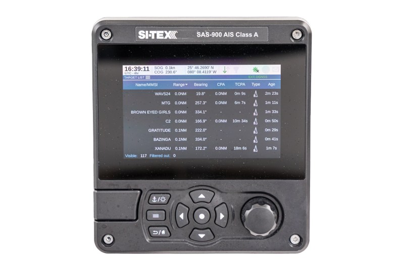
Once the information is verified, NOAA could share it with other geo-relevant vessels via Automatic Identification System alerts, and through third-party-generated messages sent to multifunction displays. These location-specific communications would advise boaters when to exercise throttle control.
These options are scalable and cost-effective, the stakeholders say. “We want alerts on their multifunction displays, and we’re very sensitive to the idea of alert fatigue,” DePersenaire says. “We want this information to be relevant and accessible to boaters in a way that’s not clunky or cluttered, or requires them to open up an app.”
Bidirectionally flowing information also reduces the need for each vessel to carry sophisticated electronics, as information gathered from one sensor-rich vessel could be shared. “There’s ways that we can expand the reach of the technology beyond the boat that it’s bolted to,” DePersenaire says.
Provided, of course, that proprietary electronics cooperate. This is where the WAVS Taskforce’s boat—a Contender 24S that carries equipment from 13 companies—pays dividends.
“On the WAVS vessel, we have multiple manufacturers’ multifunction displays and cameras,” says Shaun Ruge, Garmin’s director of marine business development. “Garmin believes, and I don’t think we’re alone here, that reducing strike risk is a cause worth advocating for alongside our competition.”
In addition to serving as an equipment showcase, the boat allows WAVS to identify and address interoperability problems. “There were a lot of integration issues that we had to work through to make sure that everything was seamless, and that we were moving information on and off the boat,” DePersenaire says.
Additionally, DePersenaire says, some Viking owners allow WAVS to test equipment aboard their yachts, and a National Fish and Wildlife Foundation grant enables WAVS to utilize some Viking customers’ yachts as part of its research fleet.
In terms of broader involvement, DePersenaire says, WAVS is always looking for potential research platforms. “People can always reach out to me,” he says. “If they’re really interested in helping, we can probably utilize them.”
I can’t speak for anyone else, and my dad’s sailboat didn’t pose the same whale-strike risk as a sport-fishing rig, but we would have provided whale-observation information if our electronics had supported it. We also would have complied with speed controls—especially if the restriction was derived from area- and time-specific data instead of overly broad regulation.
The post How Marine Electronics Could Save North Atlantic Right Whales appeared first on Yachting.